Understanding LiDAR annotation best practices is essential to solving the biggest data challenge in autonomous driving: labeling complex 3D spatial and temporal data from LiDAR and fused sensor arrays. Autonomous vehicles (AVs) can’t just “see” an object. They must locate it, define its dimensions, classify it, and predict its behavior over time.
For teams building AV perception systems, mastering 4D annotation is non-negotiable. This guide covers the core challenges, proven workflows, and quality frameworks that separate production-grade annotation from unreliable training data.
Table of Contents
The Market Imperative: Why Precision Matters
Demand for high-quality annotation is fueling rapid industry growth. The global autonomous vehicle data annotation market is projected to expand at a CAGR of 21.7% from 2025 to 2033, reaching a forecasted $13.7 billion by 2033. This growth reflects the critical role of labeled data in the race to commercialize fully autonomous vehicles.
Data Complexity: The Move to 4D
Traditional image annotation lacks the depth and motion context needed for real-world AV decision-making.
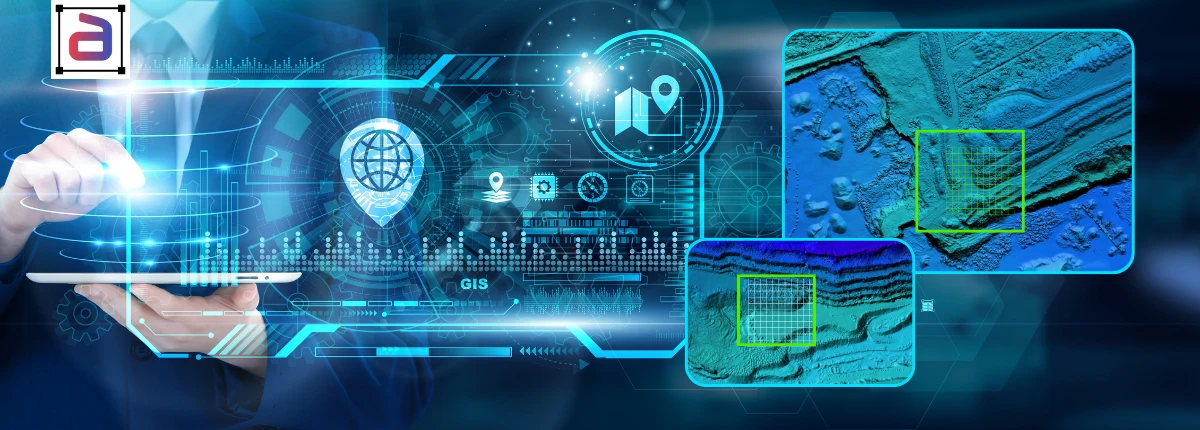
3D annotation captures an object’s geometry, size, and spatial orientation using 3D bounding boxes or semantic segmentation on point clouds. 4D annotation adds the temporal dimension — tracking each object’s identity, motion vector, and interactions across sequential frames.
The Four Dimensions of Annotation Difficulty
Annotating LiDAR and multi-sensor data presents unique hurdles that go far beyond 2D bounding boxes. Here are the four core challenges.
1. Data Volume and Sparsity
Modern LiDAR sensors generate millions of points per second, creating multi-terabyte datasets. The challenge is twofold: massive overall volume and increasing sparsity at longer distances.
Annotators must define accurate boundaries using fewer data points from farther away while navigating densely packed objects in close-range urban scenes.
2. Sensor Fusion Alignment
An AV’s perception system combines data from LiDAR (depth), cameras (texture and color), and radar (velocity). For a merged view to be accurate, every sensor stream must be perfectly synchronized and calibrated.
Even a millisecond of drift or slight misalignment in coordinate systems can introduce fatal errors into the final training data.
3. Temporal Consistency
In 4D annotation, the core task is object tracking. A pedestrian, for example, must keep the same unique ID, dimensions, and class label across every frame — even when briefly hidden behind a truck.
Inconsistencies lead to flickering labels and a poor understanding of object permanence in the trained model.
4. Edge Cases and Environmental Noise
LiDAR data is prone to significant environmental noise. Rain, snow, and fog create spurious “ghost” points. Reflective surfaces, such as glass and shiny vehicles, distort depth readings. Partial occlusions force annotators to make complex contextual judgments about object boundaries.
Annotera’s Approach to 4D Annotation Excellence
Overcoming these challenges requires a structured, multi-layered approach that prioritizes precision, consistency, and scalability. Here’s how Annotera implements LiDAR annotation best practices across every project.
1. Rigorous Data Pre-Processing and Calibration
High-quality annotation starts before labeling begins.
Noise filtration: We clean raw point clouds to remove environmental noise (rain, fog) and sensor artifacts. This ensures annotators work only with true spatial data.
Zero-tolerance calibration: We apply calibration matrices and timestamp syncing to align all sensor streams — LiDAR, camera, and radar. Precise alignment is essential for fusion-based labeling.
Frame alignment: For sequential data, we align frames using ego-motion calculations. This stabilizes the scene and makes temporal tracking significantly easier.
2. Specialized Tools and Multi-Modal Annotation
Generic annotation tools fail when dealing with 4D complexity. Annotera uses advanced platforms purpose-built for multi-sensor workflows.
3D cuboids with yaw rotation: Annotators define each object’s 3D bounding box, including its precise yaw angle (orientation). This captures the direction of travel — vital input for prediction models.
Sensor-fusion view: Annotators view the LiDAR point cloud and the corresponding 2D camera image simultaneously. The camera’s texture and context help resolve ambiguities in sparse LiDAR data.
Temporal interpolation and tracking: Tools enable automatic forward and backward tracking to maintain object IDs across frames. Human reviewers then validate the interpolated labels to ensure persistence through occlusions.
3. Human-in-the-Loop with Expert Review
AI-assisted pre-labeling accelerates the workflow, but human expertise is irreplaceable for edge cases.
AI pre-labeling: Pre-trained models auto-annotate common objects in clear frames, dramatically improving speed.
Expert oversight: Trained annotators who understand AV perception and traffic laws review and refine auto-labels. They focus on complex scenarios like intersections, lane merges, and partial occlusions.
Consensus modeling: For highly ambiguous or safety-critical edge cases, multiple annotators label the same frame. A senior expert adjudicates their results to create a robust ground-truth label.
4. Comprehensive Quality Control Pipeline
Annotation quality must be continuously measured to prevent label drift. Annotera implements a multi-layer QC process at every stage.
Clear taxonomy: A hierarchical class structure with granular subclasses (e.g., Vehicle → Sedan → Police Car) ensures consistency across the entire annotation workforce.
Automated metrics: We use Intersection-over-Union (IoU) and label coverage metrics to automatically flag inconsistent or low-precision labels before they reach training pipelines.
Tiered review process: Junior annotators, senior reviewers, and quality auditors examine the data in sequence. Errors are caught and escalated at multiple stages before final delivery.
The Annotera Advantage
The future of autonomous driving depends on the quality of training data. By 2030, analysts project that 3D and point-cloud workflows will grow at a 23.3% CAGR — signaling the industry’s decisive shift toward geometric and temporal data.
At Annotera, we don’t just label data. We engineer the perception pipeline. Our commitment to high-fidelity, 4D-consistent annotation ensures your AI models can handle the chaotic, dynamic reality of the road.
By eliminating annotation errors at the source, we give your team the confidence to deploy safer, smarter autonomous systems.
Ready to accelerate your perception model with 4D precision? Contact Annotera today to discuss our specialized LiDAR and sensor fusion annotation solutions.