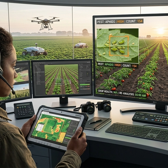
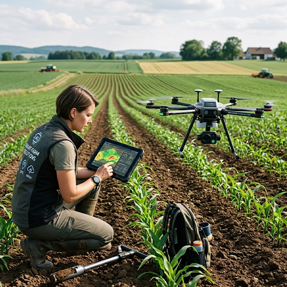
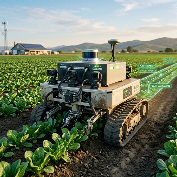
The tools reading the land now include computer vision models, autonomous tractors navigating by LiDAR, and disease detection systems that catch early blight before any human eye can. Annotera provides the agricultural AI training data that makes them work, across drone footage, satellite imagery, multispectral feeds, 3D point clouds, and livestock video, labeled accurately and at scale.
A model trained on indoor warehouse images and then pointed at a wheat field will fail quickly. Agriculture is one of the most visually complex environments in computer vision. Crops change appearance week by week as they move through growth stages. Weeds mimic the leaf structure of the plants they compete with. Disease symptoms start as subtle color shifts before they become obvious lesions. A cow standing in shadow looks different from the same cow in direct afternoon sun, but a livestock monitoring system needs to recognize both.
Add to that the data modalities involved. RGB imagery is only part of the picture. Precision agriculture teams work with multispectral cameras that capture light the human eye cannot see, NDVI data that reveals vegetation stress before it shows visually, thermal sensors tracking soil temperature gradients, and LiDAR point clouds mapping field topology. Each requires different annotation techniques and different domain knowledge in the annotator.
Then there is scale. A single drone survey of a large commercial operation can produce tens of thousands of frames. Satellite imagery covers entire regions. The annotation operation has to be big enough to handle that volume without letting quality slip, and fast enough to fit into model retraining cycles that run weekly or monthly.
That is the environment Annotera is built for.
The foundational task for most agricultural AI programs is teaching a model to identify what it is looking at in a field: this is corn at VT stage, this is a bare patch, this is early canopy stress, this is a weed.
We annotate crop imagery for species identification, growth stage classification, canopy coverage estimation, and row structure mapping. Our annotators work with bounding boxes for fast, high-volume detection tasks and polygon or mask annotation where exact plant outlines matter, as in precision spot-spraying applications where the system needs to know not just that a weed is present but exactly where its boundary is before triggering the nozzle.
Data sources we work with: drone-captured RGB imagery, satellite multispectral feeds, ground-level camera rigs on autonomous implements, and handheld scouting device footage.
Catching a problem early is worth far more than treating it late. A disease detection model that flags early blight in potato leaves at the first visible symptom, rather than two weeks in, changes the economics of the intervention. The same is true for weed detection: a model that identifies a weed seedling at cotyledon stage can direct a micro-dose application; one that waits for the weed to be obvious has already lost ground.
Annotating for early detection is more demanding than annotating mature, obvious examples. Symptoms are subtle. Boundaries between affected and healthy tissue are not clean. Weed seedlings at certain stages are nearly identical to crop seedlings of the same age. We train annotators specifically on the failure modes: the images where the symptom is present but faint, the images where the weed and the crop look almost the same, the images where lighting conditions make the call difficult.
What we label: lesion boundaries and severity staging for fungal, bacterial, and viral diseases; weed species classification and density mapping; pest presence and infestation level indicators; crop stress regions from NDVI and multispectral data.
Soil annotation works differently from crop annotation, and it requires different expertise. Rather than identifying discrete objects, annotators are delineating zones: this area has higher moisture retention, this boundary marks a textural shift in the soil profile, this section shows compaction indicators.
We work with aerial and satellite imagery for field zone segmentation, thermal imagery for moisture and temperature mapping, and elevation data for drainage pattern analysis and erosion risk flagging. For teams building variable-rate application models, the annotation work is about establishing the spatial relationships that let the system know how to treat each square meter of a field differently from the ones around it.
Tractors, sprayers, and robotic harvesters operating without a driver need to understand the world around them in three dimensions. A camera can tell a system there is an object ahead. LiDAR tells it how far away, how large, and in which direction it is moving. Combining those inputs correctly is what enables an autonomous implement to navigate around a worker who has stepped into the field, stop before hitting a fence post on a foggy morning, or follow a row precisely enough to avoid damaging root systems.
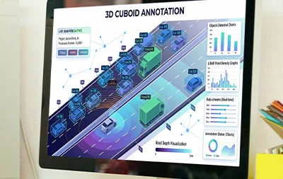
We provide 3D bounding box annotation on LiDAR point clouds for obstacle detection and classification, path planning annotation for autonomous navigation systems, semantic segmentation of driveable versus non-driveable terrain, and sensor fusion annotation that aligns camera and LiDAR frames to a shared spatial reference. Equipment types we have annotated for include autonomous row-crop tractors, robotic harvesters, precision sprayers, and seeding implements.
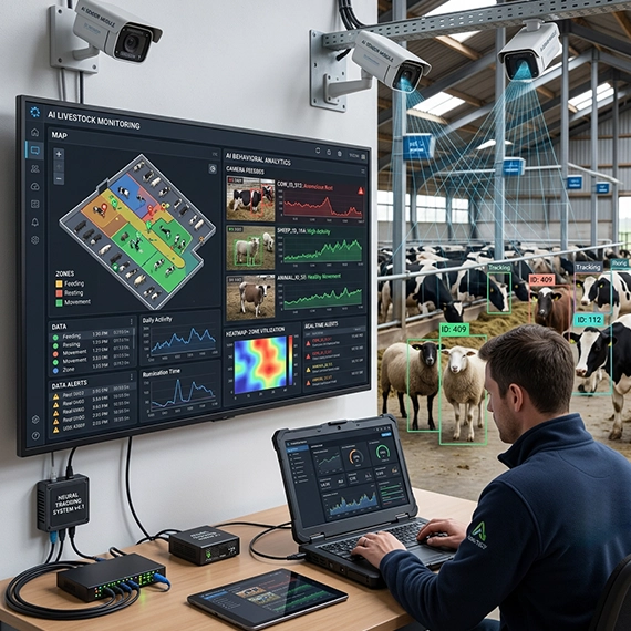
Livestock monitoring is a video annotation problem as much as an image annotation problem. What matters is not just what an animal looks like at a single moment but how it is moving, whether its gait has changed, whether it is eating and drinking at normal frequency, whether it has separated from the herd. Those patterns only emerge across time, which means frame-by-frame object tracking across video sequences.
We annotate individual animal identification across camera feeds, posture and gait classification for lameness and health monitoring, feeding and drinking behavior labels, herd density and distribution mapping, and body condition scoring labels for automated weight and health estimation. We handle the annotation challenges that make livestock video harder than it looks: partial occlusion when animals cluster, breed coat patterns that are nearly identical across individuals, and the low-contrast footage that comes from barn environments with inconsistent lighting.
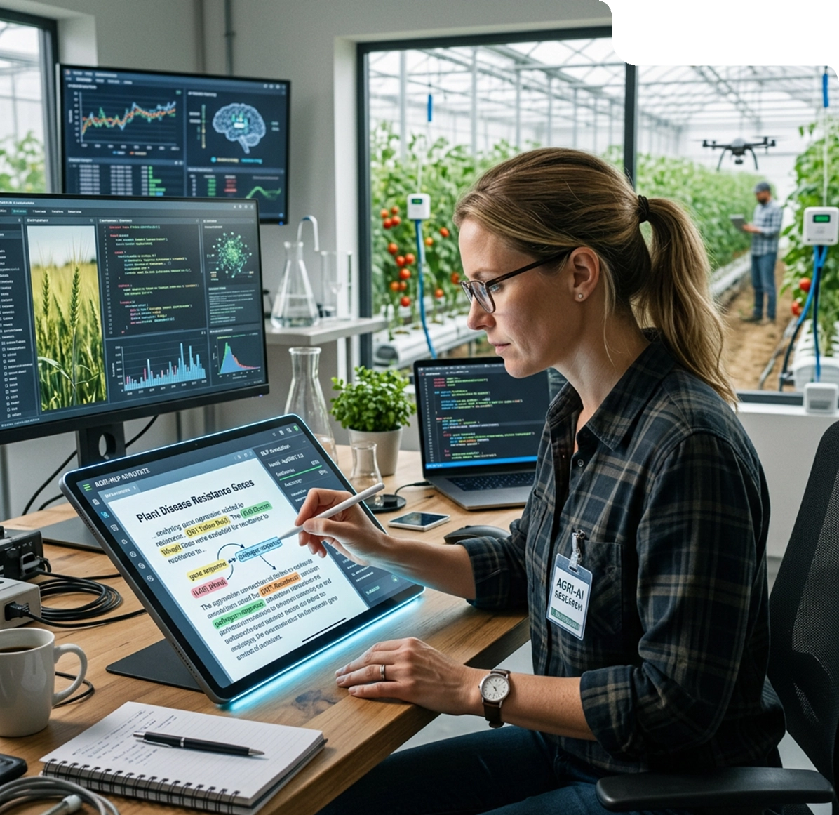
Not all agricultural data is visual. Agritech teams building tools for farm management software, food safety monitoring systems, and pest and disease surveillance platforms also need labeled text data. Farmer field notes, agronomist reports, pest and disease monitoring bulletins, weather alert logs, food safety incident reports: these documents carry information that is only useful to an AI system if someone has told it what the relevant entities and relationships are.
We provide named entity recognition annotation for crop names, pest species, chemical inputs, and geographic identifiers; event classification for pest outbreaks, disease alerts, and compliance incidents; sentiment and severity labeling for farmer report analysis; and relation extraction that maps connections between inputs, conditions, and outcomes across agricultural documents.
AI-powered surveillance systems rely on accurate data annotation to detect threats. Moreover, it improves situational awareness and therefore enhances decision-making in safety-critical environments.
for fast, high-volume detection of crops, weeds, pests, livestock, and equipment in aerial and ground-level imagery.
for precise boundary tracing of plant canopies, field zones, disease lesion areas, and soil regions where exact shape matters to the downstream model.
including pixel-level labeling for crop type maps, driveable terrain delineation, and NDVI-based vegetation zone classification.
for obstacle detection and path planning on LiDAR point clouds from autonomous equipment.
for livestock behavior monitoring, machinery path analysis, and crop growth progression studies across multi-day footage.
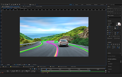
for row mapping, field boundary marking, and motion planning datasets for autonomous implements.
A model that only works in ideal conditions is not a production model. We build annotation datasets that include challenging examples by design: imagery captured at dawn and dusk, under cloud cover, in dusty field conditions, during rain. We annotate growth stages from emergence through senescence, not just the easy mid-season examples.
The hardest annotation task in agricultural computer vision is distinguishing young weed seedlings from crop seedlings at similar growth stages. We train annotators on species-specific identification guides and run inter-annotator agreement checks specifically on these difficult cases to catch and correct inconsistencies before they enter the training set.
We annotate RGB, multispectral, NDVI, thermal, and LiDAR data, and we understand how to maintain label consistency across modalities so sensor fusion models see coherent information across their inputs.
Annotera operates across multiple geographies with follow-the-sun capacity. For high-volume agricultural programs, we can run parallel annotation teams to meet tight retraining schedules without sacrificing quality.
building crop monitoring, disease detection, and yield prediction platforms who need labeled training data at commercial scale.
developing self-driving tractors, robotic harvesters, and precision sprayers who require LiDAR, camera, and sensor fusion annotation.
going from research prototype to production model who need a partner that can handle both small pilot datasets and rapid scale-up.
building AI-powered recommendation engines for seed selection, fertilizer application, and crop protection products.
deploying computer vision for quality inspection, pack house automation, and traceability systems.
Annotera’s agriculture annotation work sits alongside a broader set of services relevant to agritech teams
for livestock behavior monitoring and drone footage analysis
for autonomous equipment navigation and field mapping
for farm management software and food safety document processing
Agricultural AI programs fail more often on data quality than on model architecture. Tell us what you are building and we will scope a 48-hour pilot that shows you exactly what accurate, domain-specific annotation looks like on your data.
Annotera is the data annotation and AI training data arm of Omind AI, backed by Fusion CX’s global delivery network across 12 countries. 1,500+ dedicated annotation specialists. 99%+ accuracy benchmark. ISO 27001-aligned data security. Follow-the-sun delivery for high-volume agricultural programs.
Here are answers to common questions about text annotation, accuracy, and outsourcing to help businesses scale their NLP projects effectively.
Precision agriculture AI uses several annotation types depending on the application. Object detection models for crop counting and pest identification typically use bounding boxes. Precision spot-spraying systems need polygon or mask annotation to know the exact boundary of a target weed before triggering a nozzle. Soil mapping and field zone segmentation require semantic annotation at pixel or region level. Autonomous equipment relies on 3D cuboid annotation on LiDAR point clouds for obstacle detection and path planning. Livestock monitoring uses video annotation with object tracking to follow individual animals across frames. Most production agricultural AI programs use a combination of these techniques across multiple data modalities including RGB imagery, multispectral feeds, NDVI data, and thermal sensors.
Agricultural annotation is harder than most image annotation for three reasons. First, the subject matter changes constantly: crops move through distinct growth stages that alter their appearance week by week, and disease symptoms or weed seedlings in early stages look nearly identical to healthy plants of the same age. Second, agricultural AI uses multiple sensor types simultaneously, including RGB cameras, multispectral sensors, NDVI data, thermal imagers, and LiDAR, each requiring different annotation techniques and cross-modality consistency. Third, datasets are large and geographically diverse. A model trained on crops from one region may not generalize to another if soil color, plant varieties, or climate conditions differ. Annotators need domain knowledge, not just labeling speed, to handle these challenges reliably.
Weed detection for precision spraying applications typically uses polygon or mask annotation rather than bounding boxes, because the spraying system needs to know the exact boundary of the weed to apply a targeted micro-dose without affecting surrounding crops. For general weed mapping and density estimation, bounding boxes are faster and sufficient. Pest detection in field imagery typically uses bounding box annotation for locating pest presence and region-level labeling for infestation density classification. Early disease detection in crops uses both polygon annotation for lesion boundary marking and classification labels for disease type and severity stage. The choice of technique depends on how precisely the downstream model needs to know the shape and location of the target.
Yes. Modern precision agriculture platforms use several sensor types simultaneously and need annotation teams that can work across all of them consistently. RGB imagery requires standard computer vision annotation. Multispectral and NDVI data requires annotators who understand vegetation indices and can label stress zones or crop type boundaries from non-visible light channels. LiDAR point clouds require 3D cuboid annotation and semantic point-level labeling for obstacle detection and terrain mapping. Thermal imagery requires zone-level annotation for soil moisture and temperature mapping. For sensor fusion models, annotations across modalities also need to be spatially aligned so the model receives coherent information from each input. Annotera annotates all of these data types and maintains cross-modality consistency as part of the standard QA process.
Timeline depends on dataset size, annotation complexity, and how much domain-specific training the task requires. For standard crop detection or bounding box annotation tasks, Annotera delivers a pilot dataset within 48 hours of project briefing. Full production annotation programs for complex tasks, including LiDAR point cloud annotation, multi-sensor fusion datasets, or livestock video tracking, typically move from scoping to first batch delivery within one to two weeks. Agricultural annotation programs also run on a continuous basis for teams with ongoing model retraining cycles, with batches delivered on weekly or sprint-aligned schedules. The 48-hour pilot is the fastest way to assess accuracy and fit before committing to a full program.