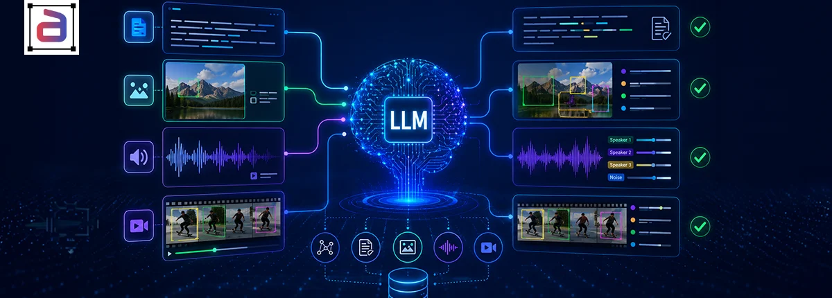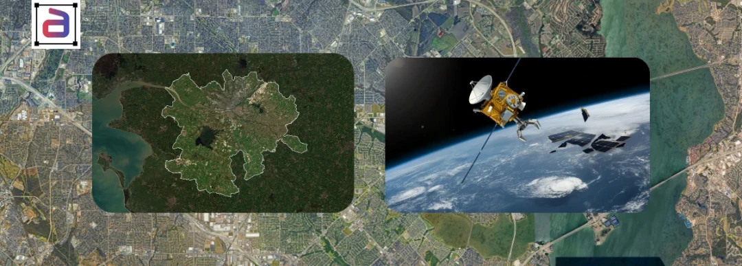
Satellite imagery has become one of the most valuable data sources powering modern Earth observation (EO) and geospatial AI systems. From monitoring deforestation and climate change to enabling precision agriculture, urban planning, and disaster response, satellite data is reshaping how organizations understand and act on the physical world. However, true intelligence does not come from imagery alone. It comes from high-quality satellite image annotation, which transforms raw pixels into structured, machine-readable insights.
At Annotera, we partner with enterprises, geospatial technology providers, and AI teams to deliver accurate, scalable image annotation services that enable Earth observation models to perform reliably in real-world environments.
Table of Contents
Key Points
- Satellite image annotation must account for the fundamental difference between satellite imagery and ground-level photography: spectral bands, resolution, viewing angle, and seasonal variation all affect what annotation conventions produce valid training signal.
- Geospatial AI annotation must maintain coordinate accuracy standards, not just visual accuracy: a polygon that looks correct but is positionally offset from its true ground location will train AI that is visually convincing but spatially wrong.
- Change detection annotation for Earth observation requires temporally consistent labeling across multi-date imagery: annotation convention changes between time points create apparent changes in training data that represent annotation drift, not real-world change.
- Satellite annotation programs must cover cloud, shadow, and atmospheric artefact scenarios that degrade image quality, as production Earth observation systems must operate under all acquisition conditions.
Table of Contents
Why Satellite Image Annotation Is Foundational to Geospatial AI
Geospatial AI systems rely heavily on supervised learning. Whether the goal is identifying crop stress, mapping urban expansion, or detecting flood damage, models must be trained on consistently labeled satellite imagery. Without reliable annotations, even the most advanced algorithms struggle with accuracy, generalization, and long-term stability.
Industry analysts consistently highlight that while satellite data volumes are growing rapidly, data quality has become the defining factor for successful Earth observation initiatives. As more organizations deploy AI-driven geospatial solutions, the role of a specialized data annotation company has become increasingly critical.
Key Use Cases Powered by Satellite Image Annotation
Satellite image annotation underpins a wide range of high-impact Earth observation applications, including:
- Precision agriculture: Annotated field boundaries, crop types, and vegetation health indicators enable yield prediction and optimized resource usage.
- Disaster response and recovery: Pre- and post-event annotations of buildings, roads, and terrain accelerate damage assessment following floods, earthquakes, and wildfires.
- Environmental monitoring: Labeling deforestation, wetlands, coastlines, and water bodies supports long-term sustainability and climate initiatives.
- Urban development and infrastructure: Building footprints, road networks, and construction activity annotations guide smart city planning.
- Maritime and defense intelligence: Vessel detection, port monitoring, and coastal surveillance rely on precise object and change-detection labels.
Across all these use cases, annotation accuracy directly influences decision-making, often in time-sensitive or mission-critical contexts.
What Makes Satellite Image Annotation Uniquely Challenging
Unlike standard computer vision tasks, satellite imagery introduces complexities that require specialized expertise and workflows:
- Multi-spectral and SAR data: Objects may appear differently across RGB, infrared, hyperspectral, or radar imagery.
- Temporal variation: Seasonal changes, crop cycles, and urban growth demand consistent labeling across time-series data.
- Scale and resolution differences: The same object may vary significantly across spatial resolutions.
- Geospatial precision: Annotations must align with geographic coordinates, projections, and sensor geometry.
- Rare-event labeling: Events such as landslides or oil spills require expert handling due to limited training samples.
These challenges are why many organizations choose to outsource image annotation rather than manage complex satellite annotation programs internally.
Why Enterprises Choose Data Annotation Outsourcing for EO Projects
For Earth observation initiatives, data annotation outsourcing is no longer just a cost decision. It is a strategic choice that affects speed, scalability, and model reliability. A mature outsourcing partner provides:
- Domain-trained annotators with geospatial expertise
- Scalable workflows for large and continuous annotation volumes
- Multi-layered quality assurance and validation processes
- Secure, enterprise-grade data handling and governance
As a trusted image annotation company, Annotera enables organizations to focus on model development and deployment while we ensure the underlying data meets production standards.
Best Practices for Successful Satellite Image Annotation
Organizations can maximize the ROI of their Earth observation initiatives by following proven annotation best practices:
- Define sensor-aware labeling guidelines aligned to specific EO use cases.
- Start with pilot projects before scaling to full production.
- Use hierarchical taxonomies to support multiple modeling objectives.
- Incorporate model-in-the-loop workflows to improve efficiency.
- Maintain detailed metadata for reproducibility and auditability.
Annotera embeds these principles into every engagement, ensuring consistency across sensors, geographies, and timeframes.
How Annotera Delivers High-Impact Geospatial Annotation
Annotera’s satellite image annotation services are purpose-built for enterprise Earth observation programs. Our delivery model combines:
- Dedicated geospatial domain experts
- Custom annotation schemas aligned to business objectives
- Layered QA frameworks for accuracy and consistency
- Scalable global annotation teams
- Flexible engagement models, from pilots to long-term partnerships
We support RGB, multispectral, and SAR imagery, as well as time-series annotation for change detection and trend analysis. This enables our clients to deploy geospatial AI solutions with confidence and clarity.
The Future of Earth Observation Depends on Better Labels
With thousands of new satellites being launched and AI becoming deeply embedded in Earth observation workflows, the demand for reliable, scalable annotation will continue to rise. For a real-world example, read how Annotera supported scalable wildfire monitoring operations with AI. Organizations that invest early in high-quality annotation — supported by an experienced data annotation company — will be best positioned to extract long-term value from geospatial AI.
Call to Action
If you are building or scaling Earth observation and geospatial AI models, Annotera can help you convert satellite imagery into production-ready training data. Whether you need a focused pilot, full-scale image annotation outsourcing, or ongoing annotation support, our team is ready to design a solution tailored to your use case. Contact Annotera today to transform your satellite imagery into reliable geospatial intelligence.